Contact us
Get in touch with our experts to find out the possibilities daily truth data holds for your organization.
Persistent Monitoring
Natural catastrophe solutions
Press release
Melbourne, Australia – April 22, 2025 - To enhance its platform’s historical flood reporting, Landchecker has partnered with ICEYE, the world's leader in SAR satellite operations and Earth observation-based natural catastrophe solutions and insights.
Landchecker is a fast and accurate all-in-one property platform used by over 160,000 property professionals. The Platform's easy-to-use map interface empowers property professionals to have the most up-to-date view on land size, planning permits, Development Applications (DAs), Zoning and Overlays, and High-Resolution Aerial Imagery, helping generate fast insights and Due Diligence on any property in Australia. Founded in 2017, Landchecker is owned by RACV and PEXA.
ICEYE’s Flood Insights is the world’s first global and always-on data utility developed for the unique needs of the insurance sector. Empowered by the world's largest constellation of cloud-penetrating satellites, we enable our clients to accurately and quickly size damage, streamline the claims process, build new products like parametric offerings, and move into untapped markets.
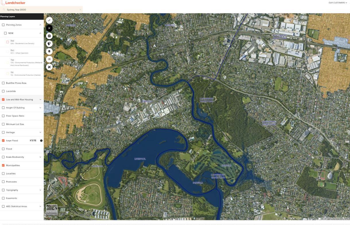
A derivative of ICEYE’s historical Flood Insights data across Australia will be available to premium tier users of Landchecker’s platform within the on-map functionality and reports of individual property locations, which conclude whether or not a flood had occurred and the estimated depth of the flood.
For a small fee, standard users can upgrade to a Premium ICEYE Flood Report that unlocks ICEYE’s historical Flood Insights outlining the impact of flood events and the flood depth of the event on properties within Australia. Paired with existing detail within Landchecker, including land size, frontage, orientation, school information, recent planning scheme amendments, proposed planning scheme amendments, aerial imagery, comparable sales, planning permit history, nearby planning permits, elevation, and digitised easements.
Adam Gandolfo, CEO of Landchecker, said: “ICEYE’s data is a game-changer for the Landchecker Platform. Access to accurate actual flood event data empowers our premium members to make informed decisions for their clients or for individuals to mitigate risk and ensure the long-term value of their properties. We're committed to continue to provide our members with the best possible data, and this collaboration is a significant step forward.”
Paul Barron, ICEYE’s Head of Global Partnerships, stated: “Landchecker’s premium customers have direct interests in historical flood information. Developers, architects, and planners need ready access to accurate data that will inform decisions efficiently. Landchecker’s platform and reports provide an efficient way to search for site potential and feasibility which are enhanced by ICEYE’s Flood Insights.”
Flooding is one of the biggest risks impacting Australian property today yet most due diligence still relies on static flood models.
Join Landchecker and ICEYE, the global leader in flood event detection via SAR satellites, to see how new technology is changing the game, Webinar link.
ICEYE delivers unparalleled persistent monitoring capabilities to detect and respond to changes in any location on Earth, faster and more accurately than ever before.
Owning the world's largest synthetic aperture radar (SAR) satellite constellation, ICEYE provides objective, near real-time insights, ensuring that customers have unmatched access to actionable data, day or night, even in challenging environmental conditions. As a trusted partner to governments and commercial industries, ICEYE delivers intelligence in sectors such as defense and intelligence, insurance, natural catastrophe response and recovery, security, maritime monitoring, and finance, enabling decision-making that contributes to community resilience and sustainable development.
ICEYE operates internationally with offices in Finland, Poland, Spain, the UK, Australia, Japan, UAE, Greece, and the US. We have more than 700 employees, inspired by the shared vision of improving life on Earth by becoming the global source of truth in Earth Observation.
Media contact
press@iceye.com
Landchecker provides an all-in-one source of property information to over 160,000 property professionals. Ingesting and refreshed daily, the data displayed in Landchecker is provided by hundreds of trusted sources, including state government, local councils, and partners. Landchecker is used by Developers, Legal Practitioners, Valuers, Real Estate Agents, Architects, Town Planners, and property consumers Australia-wide. Landchecker customers have the ability to easily see the land size, planning permits/DAs, Zoning & Overlays and High-Resolution Aerial Imagery in a map-based platform for fast, accurate and easy-to-generate insights. Landchecker was founded in 2017 and is owned by RACV, PEXA.
For further information, please visit www.landchecker.com.au and follow Landchecker on LinkedIn for the latest updates and insights.
Media contact
support@landchecker.com.au
Other assets available at https://www.iceye.com/media-assets
Get the latest news and updates from ICEYE directly to your email. Don't forget to follow us on @iceyefi & on LinkedIn. For press inquiries and further materials please refer to our Press section.