
ICEYE Natural Disaster Solutions
Actionable Flood Insights for Your Hurricane Response and Recovery Efforts
Leverage near real-time geospatial insights to assess the true impact of hurricanes at the community level
Improve situational awareness
Satellite-based insights enable government agencies to understand community impacts as a disaster unfolds. Visualize observational data and vulnerable properties in near real-time for unparalleled situational awareness on the ground.
Optimize emergency response
Rather than wait days or more for outside help, ICEYE empowers emergency managers to proactively lead disaster response and recovery efforts. Arm your teams with a single source of truth using GIS-enabled disaster intelligence.
Enhance recovery outcomes
With access to reliable disaster impact data in near real-time, your government can better protect its most vulnerable communities, assets, and infrastructure.
Boost cost efficiencies
ICEYE's fast and reliable satellite-based insights deliver granular details on natural disasters as they're occurring, allowing teams to save time and money while focusing on higher value tasks.
At the core of our data is ICEYE’s advanced Synthetic Aperture Radar (SAR) technology, powered by the world's largest SAR satellite constellation — more than 40 satellites strong and growing.
Unlike optical sensors, our SAR technology operates around the clock, capturing high-resolution imagery day or night, in any weather conditions. This ensures reliable, timely insights when emergency responders need them most.
With multiple imaging modes and a highly agile constellation, we provide rapid coverage of large-scale events with frequent visit rates, enabling emergency responders to track disaster progression in near real-time.

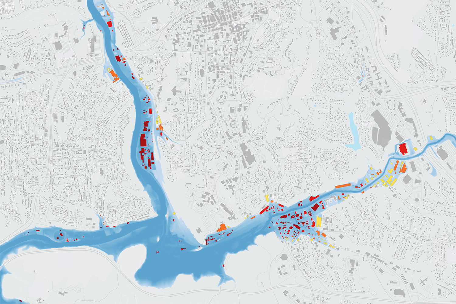
Flood
ICEYE’s Flood Insights is the world’s first consistent, near real-time source for observational flood data, allowing governmental decision-makers to understand the true impacts as a natural disaster is unfolding.
ICEYE’s building-level impact data empowers officials to quickly target relief to affected survivors, driving the capability to transform assistance delivery, and bypassing delays associated with on-ground assessments.
BETA
Wind
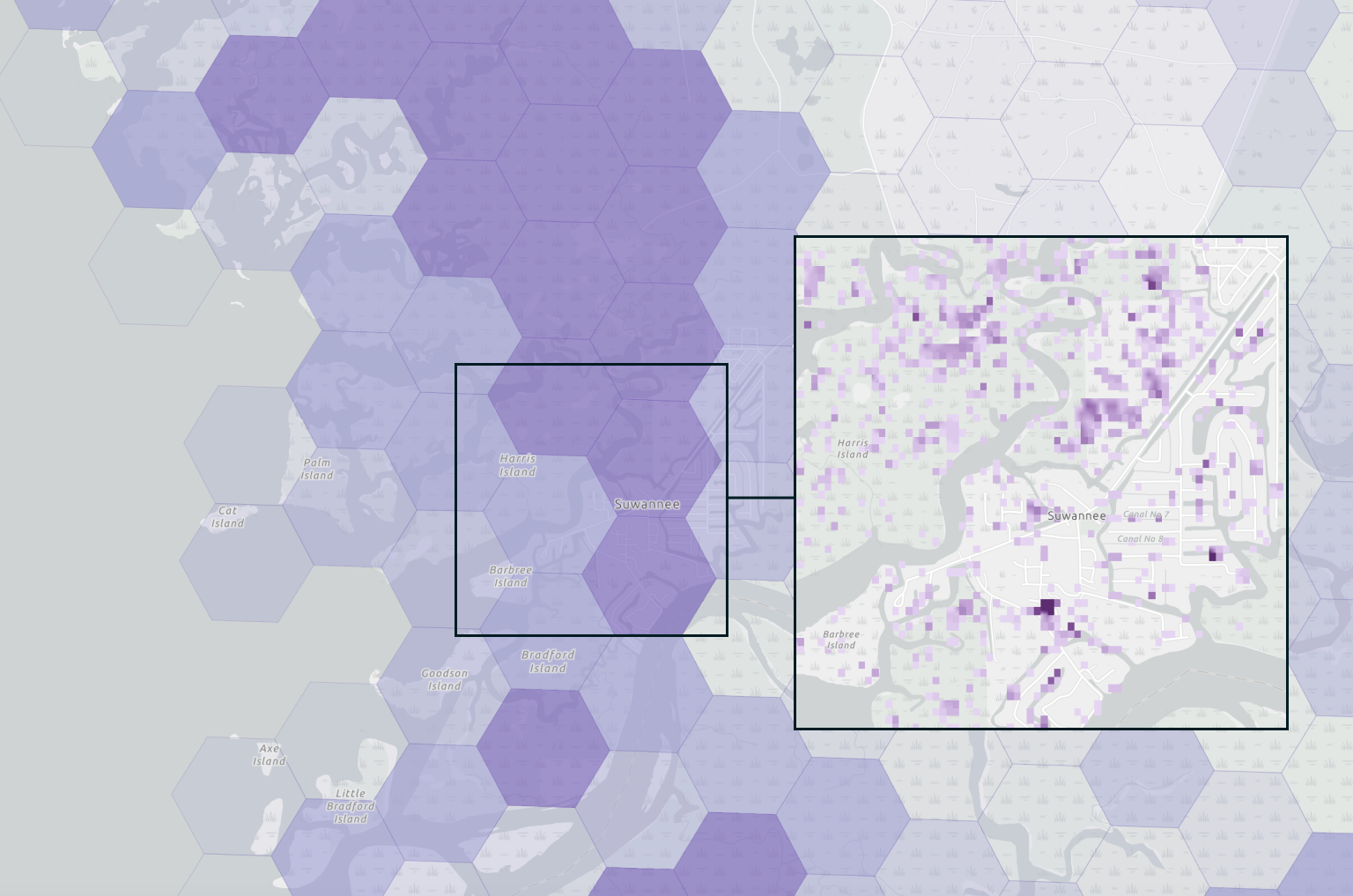
An innovative way to detect large changes to building structures after landfall of major hurricanes in the US and cyclones in Australia. Within 24 hours of landfall, our first damage heat map describes the extent of impact at the block and plot levels.
This product is currently in Beta and open for select Test customers.
Geospatial Insights
Unlock the power of ICEYE's disaster insights on Esri's ArcGIS
Learn how ICEYE's global, near real-time flood insights are delivered directly to government agencies inside ArcGIS.


