Contact us
Get in touch with our experts to find out the possibilities daily truth data holds for your organization.

13 March 2025
12 min read
When you combine phase information with persistent monitoring, you can track day-to-day changes...
Read more about Harness the magical property of SAR →
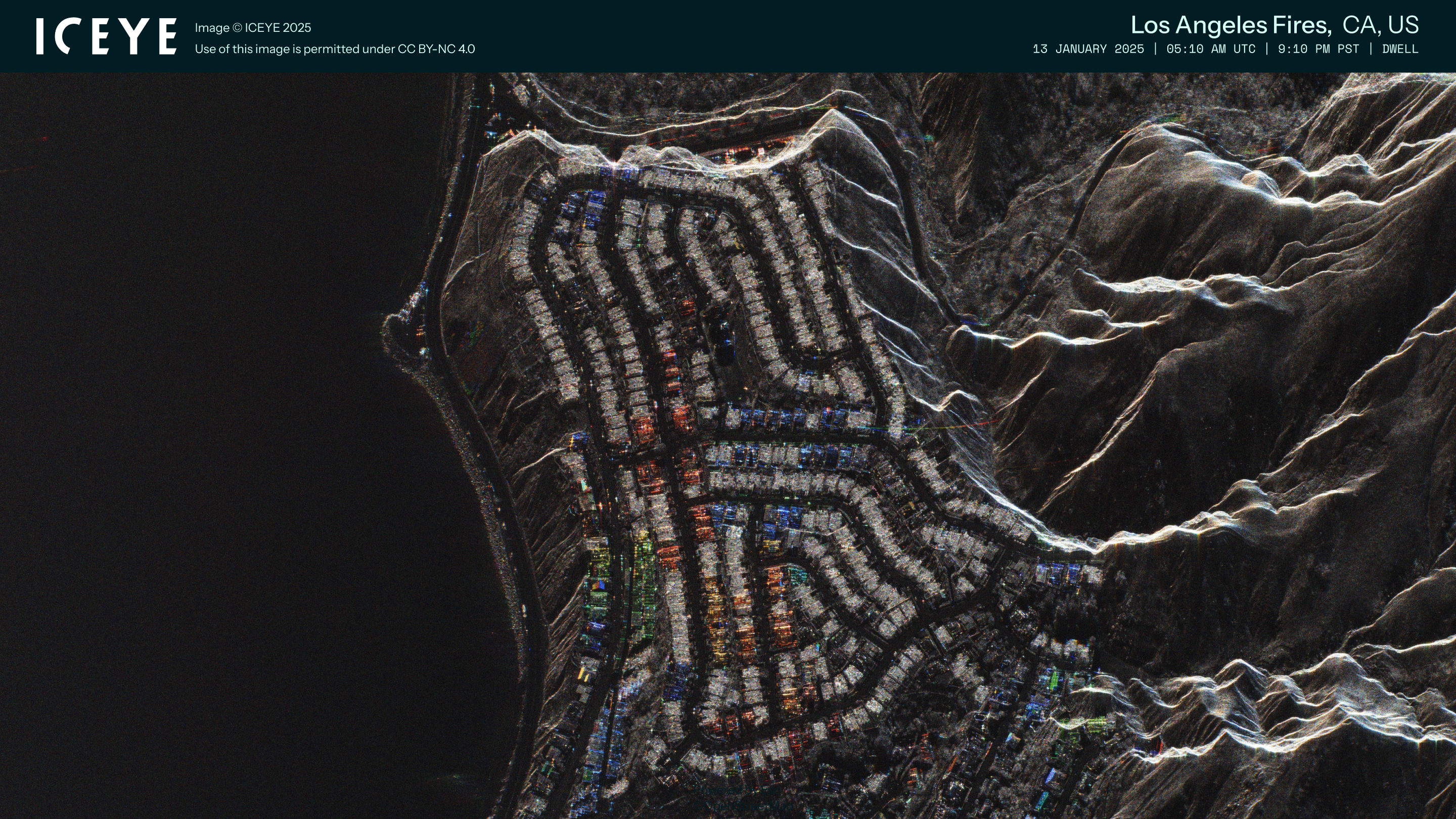
05 March 2025
12 min read
Discover how ICEYE’s observed wildfire data helped insurers and emergency managers respond to the...
Read more about Beyond 99% Precision: How ICEYE’s observed data improved wildfire response in Los Angeles →
Sign up for our monthly Insurance Solutions newsletter for regular updates about ICEYE products and exclusive insights on the most pressing natural catastrophes delivered to your inbox.

19 February 2025
9 min read
Learn how insurers can make insightful business decisions with ICEYE Flood Insights and all the...
Read more about Insurers' guide to accessing and visualizing ICEYE Flood Insights →
14 February 2025
16 min read
What brings sustainable farming, a creative marriage proposal, and ICEYE's radar satellite...
Read more about Beyond the Echo - Natalie, Will You Marry Me? →
17 December 2024
13 min read
Most of the observable components of change on earth are the result of human or geological...
Read more about Monitoring our rapidly changing Earth →
16 December 2024
8 min read
Read ICEYE's summary of the 2024 Atlantic hurricane season to understand trends, impacts, and...
Read more about Atlantic hurricane season 2024 wrap-up: trends, impacts, and future risks →
03 December 2024
9 min read
Darren Muff and the ICEYE team take a closer look at two MI-26 Hind helicopters captured in SAR...
Read more about Beyond the Echo - Helicopter rotor signature on SAR imagery →
28 November 2024
11 min read
The ICEYE SAR constellation gathers enough data to produce a wide variety of images; from...
Read more about Discover the diversity of SAR imagery →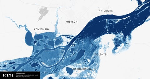
20 November 2024
7 min read
This tutorial guides you step-by-step to explore and visualize flood data for the Kakhova Dam...
Read more about Celebrate GIS Day with ICEYE and Esri’s ArcGIS Living Atlas →
08 November 2024
16 min read
SAR images are produced using microwaves rather than visual wavelengths. Learn how SAR differs from...
Read more about Seeing the world through SAR →
30 October 2024
5 min read
Darren Muff and the ICEYE team explore how many images ICEYE SAR satellites could collect when...
Read more about Beyond the Echo - Phased array with small satellites →