Contact us
Get in touch with our experts to find out the possibilities daily truth data holds for your organization.
Persistent Monitoring
Natural catastrophe solutions
10 August 2022 | Solutions
7 min read
Solutions Content Marketing Manager, ICEYE

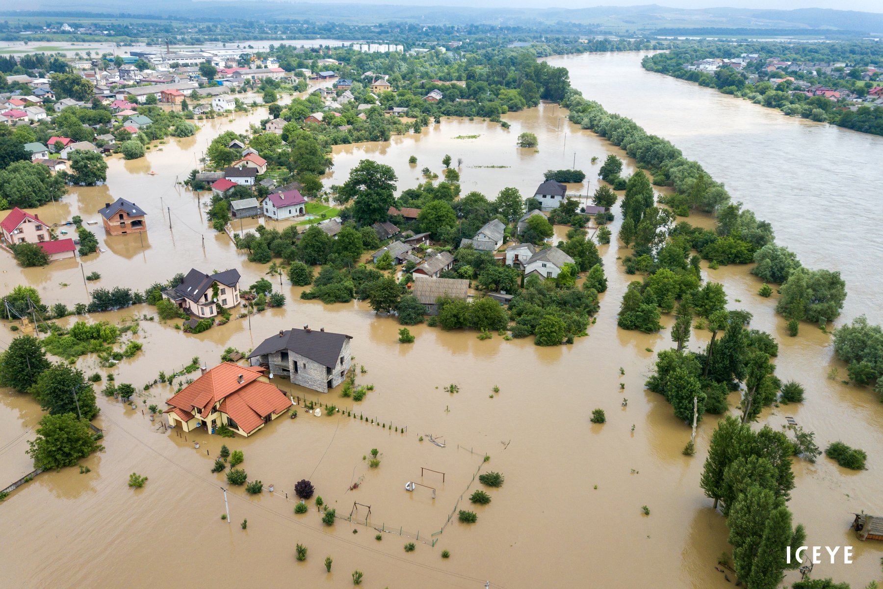
During the first days of July, a low-pressure system caused torrential rain and flash flooding in and around Sydney. For many Australians, it was their fourth or fifth flood in the past 12 months, including floods that impacted large parts of the East Coast during February and March. Insurance industry losses are expected to reach $5 billion, according to PERILS, four months after ICA declared the event a catastrophe, marking it the costliest flood in Australian history.
In Kentucky, US, rivers rose as much as 10 feet in a matter of hours, and numerous homes and cars were swept away. The death toll from the floods rose to at least 37 people at the beginning of August.
According to the World Bank, 89% of the people exposed to the growing flood risk around the globe live in low- or middle-income countries with low insurance penetration. Even in Australia and the United States, which are considered more mature insurance markets, flood risk is seriously underinsured.

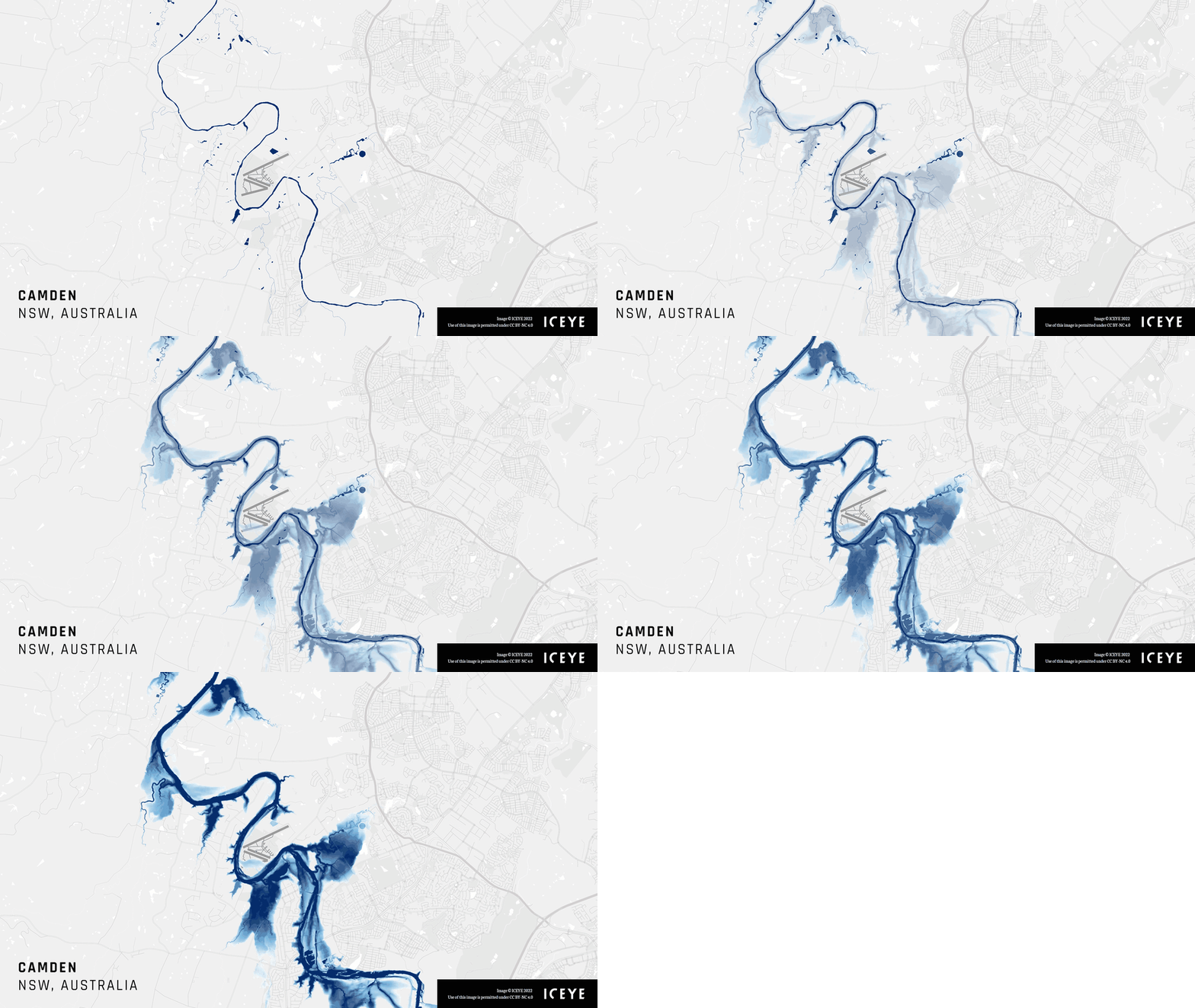
Before and after visuals capturing the flood extent and depth in Camden, Australia, as parts of the Greater Sydney area received about eight months of rain in four days.
We discussed the topic of flash floods with regards to climate change in a recent virtual debate with The Insurer TV. As Amaury Dufetel, Head of Parametric Insurance at AXA explained, the rise in average global temperatures is fuelling weather extremes and creating conditions that are more conducive to torrential rain and surface flooding.
More moisture in the air creates the potential for more severe rainfall events, but temperature extremes also impact the ability of the topography to absorb precipitation. Too much rain over a sustained period can cause water logging and increase the rate of run-off, while drought conditions can also create "rain-proof soils".
While hurricanes are relatively static in terms of frequency, they are getting wetter, observed Andrew Pedler, Head of Claims, Client Relationships and Innovation at Liberty Specialty Markets, and this is adding to the severity of overall losses.
He pointed to Hurricane Ida as a recent example of a windstorm that had resulted in extensive flood losses. "While Ida hit Louisiana as a Category 4 and caused significant damage, a lot of the claims losses - between $10-$15 billion - was caused much higher up in the US, in New York and New Jersey from flash flooding," he added.
"Take a sneak peek into our upcoming analysis of the Central Appalachia floods. This image showcases the #flood extent and depth, together with the building inundation levels after the flash flooding in Jackson, #Kentucky. https://abcn.ws/3FWFvwv"
— August 1, 2022
In light of the losses in recent years, we need to question whether floods should still be considered a 'secondary peril'. During the debate, Daniel Stander, Senior Advisor at the United Nations Development Programme (UNDP) noted that the combined $80 billion in flood insurance claims in 2021 made up an estimated 35% of the overall economic impact. In emerging markets, as much as 95% of the flood risk is uninsured, he said.
"We've done lots of work as an industry to think about coastal and event fluvial, but in high-density urban areas - where frankly we have that natural resistance (it's called concrete), and in the emerging markets where we don't necessarily have good drainage systems - that's causing a big issue."
According to Daniel, there is significant potential to harness earth observation data to close that protection gap. "I see a lot of potentials to use this technology, most likely on a parametric basis and for flash flooding in urban areas where we have a shortage of other sources of indemnity coverage," he explained. "There is potential to do something at a sovereign level or that would play out at sub-sovereign municipal level. The payouts have got to go to the right people at the right time and if we can achieve that, then we're onto a winner."
A model of how this might look already exists. In June, the Ghana Ministry of Finance, the UNDP, the German Government, and the Insurance Development Forum (IDF) launched an initiative to develop a sovereign risk transfer scheme for urban floods in Ghana.
The parametric solutions are led by IDF members Allianz and Swiss Re with triggers structured around ICEYE data to enable quick payouts when floods of a certain magnitude impact the Greater Accra Metropolitan Area.
"This is a great opportunity to help the insurance industry fulfill its societal value proposition in terms of covering a risk and bringing a more astute and risk-managed approach to international development and sustainability," said Stander.
With access to the right hazard data, there is also the potential to move from a 'response and recovery' to a 'predict and protect' approach. The recent Australian floods offered a good case study of how such risk mitigation might work in practice, according to Stephen Lathrope, Global Head of Insurance at ICEYE.
"We knew the weather system in Australia was going to be moving south and we knew where we thought the flooding was going to be developing, so this insight does give people the opportunity to do things [in advance] that will save them hassle and the insurer money."
ICEYE's satellite radar (SAR) data is not just used to observe the aftermath of a dynamic peril such as floods, he explained. It captures events as they are unfolding in near real-time with the ability to see through clouds and at night.
"It is interesting how many of our insurance partners say they just want to get to their customers quicker and help them," he added. "If you can get the information to them quickly enough, you can even mitigate some of the loss."
If you're interested, you can learn more about ICEYE’s Flood Monitoring solution or download our latest Flood Briefings here.
11 June 2025
6 Data-driven strategies emergency managers should use for hurricane preparedness
How Emergency Managers can ensure data readiness ahead of hurricane seasons.
Read more about 6 Data-driven strategies emergency managers should use for hurricane preparedness →27 May 2025
Hurricane Solution FAQ for insurers
ICEYE’s new Hurricane Solution offers something insurers have never had before: observed wind and...
Read more about Hurricane Solution FAQ for insurers →24 April 2025
Forecasting complexity: What the 2025 hurricane season brings for disaster response
Explore what the 2025 hurricane season could bring and how real-time observation enhances hurricane...
Read more about Forecasting complexity: What the 2025 hurricane season brings for disaster response →