Contact us
Get in touch with our experts to find out the possibilities daily truth data holds for your organization.


17 October 2024
4 min read
Explore ICEYE Flood Insights' role in enhancing New Zealand flood response efforts and disaster...
Read more about Effective flood response with ICEYE Flood Insights in New Zealand →
30 September 2024
8 min read
Access ICEYE's observed data on Hurricane Helene and its impact in the Florida panhandle, Georgia...
Read more about Monitoring Hurricane Helene: satellite-powered insights →
Sign up for our monthly Insurance Solutions newsletter for regular updates about ICEYE products and exclusive insights on the most pressing natural catastrophes delivered to your inbox.

17 September 2024
10 min read
Learn about ICEYE synthetic aperture radar (SAR) imaging techniques and how radar impulses are used...
Read more about Beginner’s guide to synthetic aperture radar (SAR) technology →
25 July 2024
6 min read
Discover how ICEYE is advancing satellite-powered disaster response and emergency management at...
Read more about Shaping the future of satellite-powered disaster response →
10 June 2024
3 min read
ICEYE, a global leader in satellite-powered disaster management solutions, announced this month it...
Read more about ICEYE becomes Esri Gold Partner amid growing footprint in GIS ecosystem →
05 June 2024
1 min read
ICEYE joins the United Nations Global Compact to advance sustainability and corporate responsibility
Read more about ICEYE joins the United Nations Global Compact to advance sustainability and corporate responsibility →
08 May 2024
5 min read
Learn about El Niño and La Niña's impact on the 2024 hurricane season with expert insights from...
Read more about Understanding El Niño and La Niña: A Meteorologist's perspective on the upcoming hurricane season →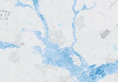
22 April 2024
6 min read
Learn how radar satellites can transform flood surge response for UK insurers, providing accurate...
Read more about How radar satellites are transforming flood surge event response for UK insurers →
22 March 2024
3 min read
ICEYE’s journey started ten years ago with an idea to monitor the movements of the Arctic ice –...
Read more about ICEYE cooperates with WWF to protect ‘blue corridors’ - whales’ migration routes in the Arctic →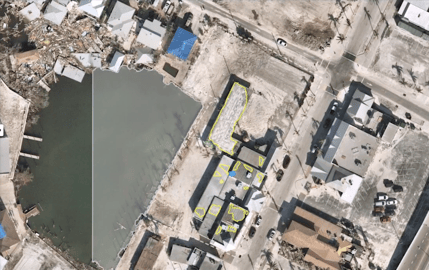
28 February 2024
6 min read
Explore how geospatial property intelligence is revolutionizing insurers' approach to managing...
Read more about Managing climate risk with geospatial property intelligence for the insurance sector →
23 February 2024
7 min read
See the highlights from Esri FedGIS 2024 and learn how ICEYE's satellite-powered disaster...
Read more about See our photos, highlights, & commentary from Esri FedGIS 2024 →