Contact us
Get in touch with our experts to find out the possibilities daily truth data holds for your organization.

28 February 2024
6 min read
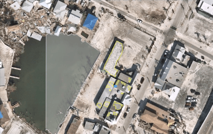
Explore how geospatial property intelligence is revolutionizing insurers' approach to managing...
Read more about Managing climate risk with geospatial property intelligence for the insurance sector →
23 February 2024
7 min read
See the highlights from Esri FedGIS 2024 and learn how ICEYE's satellite-powered disaster...
Read more about See our photos, highlights, & commentary from Esri FedGIS 2024 →
Sign up for our monthly Insurance Solutions newsletter for regular updates about ICEYE products and exclusive insights on the most pressing natural catastrophes delivered to your inbox.

09 November 2023
3 min read
Learn more about ICEYE's new partnership with the European Space Agency (ESA) to develop an...
Read more about A New Frontier in Earth Observation: The ICEYE x European Space Agency (ESA) Partnership →
30 August 2023
6 min read
We gathered 10 burning questions to help you better understand the art of the possible with our...
Read more about 10 Burning Questions About Rapid Building-Level Damage Detection - Demystifying ICEYE Wildfire Insights →
19 July 2023
2 min read
As a member of Esri PAC, ICEYE's Paul Barron will have direct collaboration opportunities with...
Read more about ICEYE's Paul Barron Has Joined the Esri Partner Advisory Council (PAC) →
30 June 2023
5 min read
Delve into the 2023 wildfire and hurricane season with ICEYE's meteorologist, Brandon Wright, and...
Read more about Navigating Extreme Weather: An In-depth Look at the 2023 Wildfire & Hurricane Season →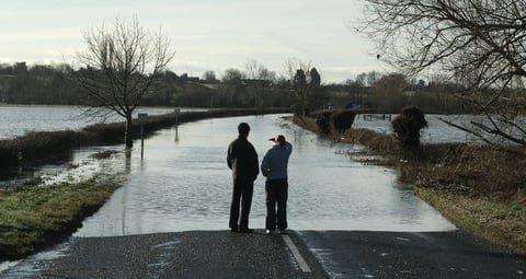
15 June 2023
4 min read
Explore how SAR technology and ICEYE satellite data revolutionize flood claim triage, expediting...
Read more about Harnessing SAR Technology for Efficient Flood Claim Triage, Speedy Settlements, and Reduced Late Reporting for Insurers →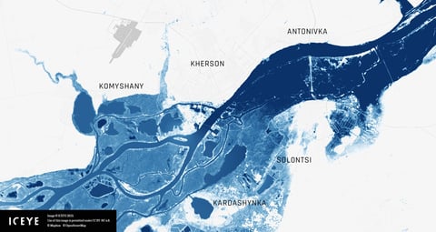
08 June 2023
6 min read
See ICEYE's flood analysis for the Nova Kakhovka dam breach in Ukraine, enabling on-the-ground...
Read more about Full Scale of Flooding in Ukraine's Kherson Oblast Captured by ICEYE Analysis →
12 May 2023
4 min read
Discover how ICEYE's SAR technology transforms wildfire monitoring, offering real-time data for...
Read more about Revolutionizing Wildfire Monitoring with ICEYE's SAR Technology →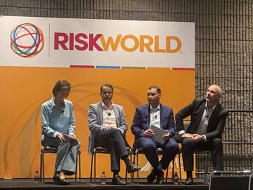
05 May 2023
5 min read
Stephen Lathrope, ICEYE's Global Head of Insurance, took the stage at the RIMS 2023 Conference to...
Read more about Providing Data For The Parametric Insurance Buyer →
23 February 2023
6 min read
Learn how SAR technology provides valuable insights to insurance companies so they can act...
Read more about See Through Clouds: How SAR Technology Helps Insurers Stay Ahead of Natural Disasters →